Inland Rail is a huge project, involving 13 individual sections that span more than 1,700km. It is the largest freight rail infrastructure project in Australia and one of the most significant infrastructure projects in the world. You can learn more about the project here.
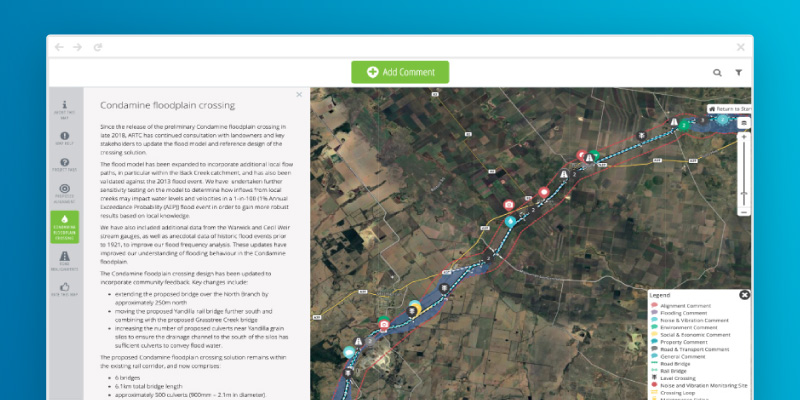
To ensure that their communities had access to the level of detail they needed in a map, they chose to use Social Pinpoint to create interactive maps for the various areas of the project. The maps feel familiar to users as they use Google Maps as the base and allow community members to drop comments and questions in real-time. All questions and comments, and Inland Rail’s responses, can be seen by the public which offers a transparent way of providing real-time feedback and addressing issues in various geographic areas. Social Pinpoint integrates directly with their Stakeholder Relationship Management Platform, Consultation Manager, which means that their data is automatically kept up to date.

